Why GI Learner?
Spatial thinking is one of the fundamental forms of intelligence needed to function in modern society, and that the development of such skills should be part of everyone’s education. (Michael Goodchild)
…or
Spatial thinking is the catalyst to improve understanding of subjects across the curriculum and as a way of thinking that crosses disciplinary boundaries (Bednarz).
A European priority
Almost all aspects of our economy and society are based on geoinformation and geotechnologies. More than 80% of all information produced today had a geospatial component. Citizens are being empowered by geospatial technologies and geodata, not simply
ICT. People are tracking, mapping and communicating geographically on an unprecedented scale.
 The Eurogeographics Association (
http://eurogeographics.org
/) confirmed that the sector is booming: employment rose to about 550,000 in 2014, despite the crisis. However there is a clear mismatch between workforce demand and supply. The GI sector is in many countries a shortage
occupation sector. An inquiry in Flanders for example showed that on average every year only 1/3 of the available jobs is filled due to lack of students leaving high school or university without the necessary skills and knowledge.
This is a big problem, not only for those companies, but also for our society as every year a lot of students finish their studies but don’t find a job. Many GI Science study programmes are dealing with informatics, but it appears that they focus
more on informatics than on the scientific background of spatial thinking. GI Science is almost never really taught.
 Unknown is unloved: If we can introduce the use of GI Science in secondary education, we may not only show its importance for todays’ society, we might even persuade youngsters to choose a study that deals with GI Science, thus increasing
dramatically their chance of finding a good job. So we need policy developments that build a European education/training system with the capacity and capability to raise awareness of the GI sector, create a geospatially literate workforce
and European citizens who can benefit from these developments. The major outcome of our project will deliver material for rewriting the curricula end educational programmes in favor of pupils and thus for their future and employment
in tomorrow’s society. One of the priorities of the European Union the last decade has been the promotion of “digital literacy.” This relates to the ability to use ICT and the Internet as a new form of literacy. According
to the European Commission, it is fast becoming a prerequisite for creativity, innovation and entrepreneurship and without it citizens can neither participate fully in society nor acquire the skills and knowledge necessary to live
in the 21st century. Integrating digital competences can be understood in many different ways, from the most restrictive, such as the uses of computers, e-learning and Internet, to some other definitions that situate it close to a
broader training and general preparation for life (literacy) in the age digital.
 The following comment by Martin (2010) summarises the issue: “Digital integration concerns the awareness, attitude and ability of individuals to appropriately use digital tools and facilities to identify, access, manage, integrate, evaluate, analyse and synthesize digital resources, construct new knowledge, create media expressions, and communicate with others, in the context of specific life situations, in order to enable constructive social action; but also to reflect upon this process.”
The priority concerns acquiring and using knowledge and techniques, but also is related to attitudes and personal qualities, and incorporates the ability to plan, execute and evaluate digital actions in the solution of life tasks,
and the ability to reflect on one’s own digital personal and professional development.
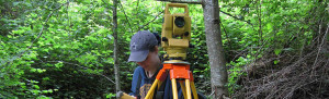
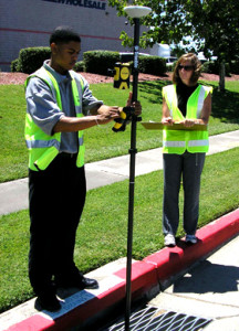
Geo-ICT including geospatial thinking is essential in education. It is not simply about visualization and relationships, it implies manipulation, interpretationand explanationof information … at different geographic scalesusing GI tools. To observe patterns, associations, and spatial order. Its importance has been acknowledged in the “European Reference Framework, Key Competences for Lifelong Learning” document published by the DG EAC.
Description of the project
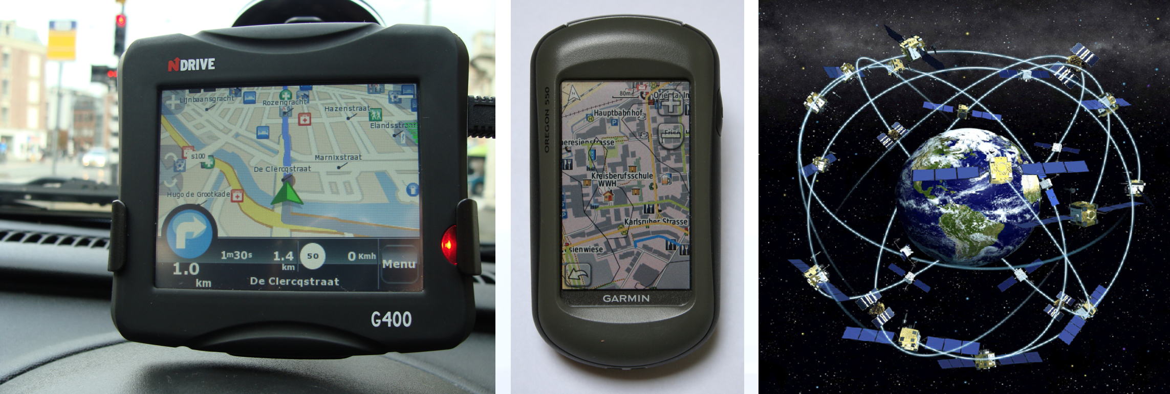
Spatial thinking using GIScience tools is integral to everyday life. With the use of online mapping tools, GPS and car navigation the general public has become aware of the possibilities of spatial data. It is the concept of space that makes spatial thinking
a distinct form of thinking. It is a basic and essential skill that can and should be learned, alongside other skills like language, mathematics and science.
 Based on a US Department of Labor study, Gewin (2004) proposed in ‘Nature’ that GIScience (with related spatial thinking skills) would become one of three most significant technological advances for economic development in the next
decade. Since then, in the United States there has been a strong lobby for geospatial education, resulting in Congress acknowledging the significance of the National Academies Press publication “Learning to Think Spatially” (National
Research Council, 2006). This has transformed the US research and education technology agenda and, as a result, the National Science Foundation (2011) recently awarded significant grants to geospatial education research. In Europe
most developments have been small scale, and without backing from political stakeholders. The knowledge and capability to use GIScience and Geographical Information (GI) is not only essential as a basic skill, it also offers significant
job opportunities. The Eurogeographics Association (http://eurogeographics.org/) that in the last 5 years the Geographic Information Sector in Europe is booming: employment rose to about 550,000 in 2014, dispite the crisis.
However there is a clear mismatch between workforce demand and supply. The GI sector is in many countries a shortage occupation sector. An inquiry in Flanders e.g. showed that on average every year only 1/3 of the avialable jobs
is filled in due to lack of students leaving high school or university with the necessary skills and knowledge. This is a big problem, not only for those companies, but also for our society where every year a lot of students finish
their studies bit don’t find a job. So we must increase education activities to produce the workforce we need now and for the future. The goal is to integrate spatial literacy, spatial thinking and GIScience into schools
 Bednarz & van der Schee (2006) made 3 recommendations for a successful introduction and integration of GIScience in schools:
- Address the key internal issues related to GIS implementation: teacher training, availability of user friendly software, ICT equipment in schools.
- Use a community of learners approach.
- Institutionalize GIScience into curricula, making sure that it is aligned with significant general learning goals like graphicacy, critical thinking and citizenship skills.
In terms of the first two recommendations a lot of progress has already been made:
- There have been training opportunities for teachers (e.g. iGuess project), schools nowadays generally have good ICT equipment and software, and data are more widely and freely available.
- The Digital-Earth.eu network has launched in many countries, and designated a number of ‘Centres of Excellence’. These centres help building up the community of geomedia learners, e.g. by collecting and disseminating good practice
examples and organizing informal sessions with teachers. Nevertheless surveys done by the Digital-earth.eu network (2012) and Ghent University (2014) indicate teachers’ request for more training, teaching materials, good practices
and a comprehensive and well-structured compilation of digital-earth tools. - The third recommendation is still critical. The notion of GIScience, GI or spatial thinking is uncommon in almost every country. (iGuess report, Donert et al, 2009).
Some steps have been achieved:
- a benchmark statement has been developed (Herodot Network, 2008; digital-earth.eu network 2013), intended to give a rationale and recommendations on the implementation to teacher trainers, teachers and headmasters, but also
to policy and decision makers. - Competencies mentioned in the benchmarks have been translated into a basis for a learning line (Woloszynska et al 2013; Zwartjes, 2014) whereby teachers need to be able to choose suitable tools to use, based on the abilities of their
students, their own capabilities and their curriculum.
 These steps showed the importance and possibilities, but remained to much for the small group of early adaptors. If we want to overcome the shasm in introducing GIScience in schools we must introduce and institutionalize it inside
the curricula of the schools. This must be done taken into account the level of difficulty connected to the age group. The main focus of the project will therefore be the development of a real learning line on GIScience in education.
We need to translate the competencies – taking into account age and level – into real learning objectives in a number of different subjects.
Timeline
 The project followed these different stages:
- Following the initial start-up meeting, the project was initiated by doing an in-depth analysis of the most important literature on learning lines and spatial thinking within the curriculum, as this was an important first stage in
the development of the learning materials. Ten spatial thinking competencies then emerged following lengthy discussions and peer review and amendments and adaptations. Importantly, all ten competencies are required to develop geospatial
thinking in GI Science. For curriculum development purposes, the 10 competencies have been further developed into a learning line. We labelled these A, B and C, so that there was a degree of progression within each competence, as well as between each competence.
In order to create a learning line, the GI Learner competence levels (A, B and C) were then summarized across the K7-K12 curriculum, a model that has been developed through feedback from attendees at a number of events across Europe
and other continents, where they were introduced and discussed 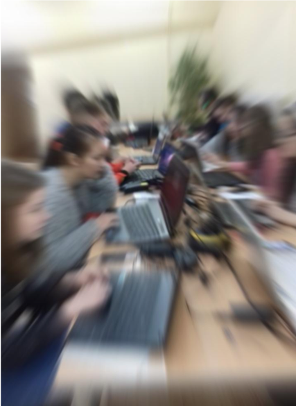 To link the competencies to real curriculum content all partners then scanned the curricula to identify opportunities to introduce GIScience in a range of subjects (and not just the ones where their particular subject expertise
lay). Where matching content across the five countries involved was found, it was selected and used for the exercises that followed.This required some further discussions, as the timing of some of these themes and topics were not
always easy to synchronise across the EU.- For each year different exercises were then written, trialled and edited. These were linked to the curriculum, and mapped to the competencies and level of difficulty for each group. Teachers accessing these materials can replace
an their existing lesson topic with one of the lessons provided. If this is done for each year (with at least 2 lessons) the implementation of the learning line will be fruitful, we feel. Guidance is given on how this might be
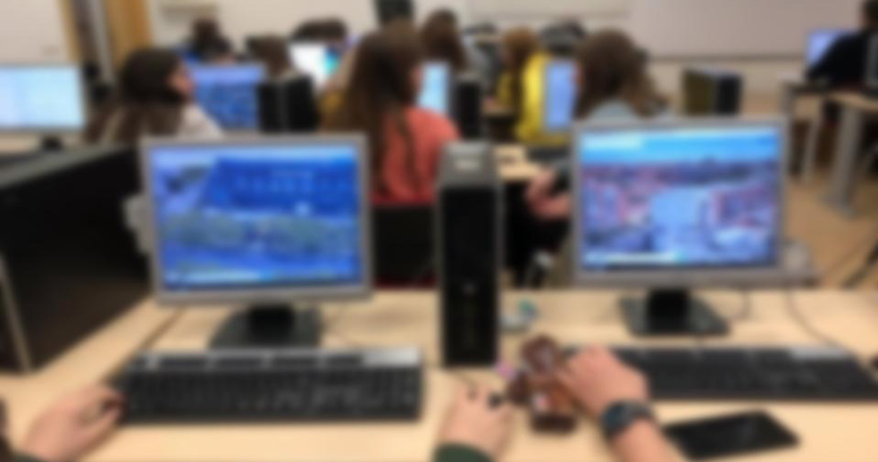
done. - To test the developed materials we needed the cooperation of the target group: the pupils at the partner schools. The participating schools selected a group of pupils K7 (aged 12) and K10 (aged 15). They became the ‘guinea pigs’
for GI Learner, as they were asked to ‘test the test’, by accessing the materials and give their feedback and provide their amendments. This continued for the following two years, so that after the three years of the project, all
levels of secondary education were completed.To measure the impact of the learning lines on spatial thinking a self-test was therefore developed, taking into account the level of complexity of each competence (A, B or C) for each
age group. The test consists of several parts, related to the selected learning outcomes /competencies which were developed. The tests were completed at the start of the project (providing an 0-value) and at the end of every
year and took into account the comments and opinions of the pupils involved during the project.
- The feedback and comments of the pupils lead to adjustments and guidelines for us for the newer exercises. Thus the learning line with the exercises was sometimes rewritten and adjusted to a correct level. The materials were trialled
in the partner schools.With all the feedback that was provided, the final learning lines with accompanying exercises were completed in different draft formats ahead of the ‘final’ stage where they were used during the mobilities.
It is anticipated that further work will continue beyond the lifetime of the project, as colleagues continue to use the materials, and adapt them to their own national circumstances.
- Finally a publication with amendments for inclusion into the national curricula was produced and disseminated among the different national ministries of education. This was intended to provide some rationale for the inclusion of GISciences within new curriculum change, or perhaps by awarding bodies.
 The team of GI-Learner
Project consortium
Sint-Lodewijkscollege, Brugge Belgium (coordinator)
Sint-Lodewijkscollege is a secondary general education school with a long tradition in Bruges on European projects, in fact we were one of the founding fathers it and we already had projects going on before the start of the programmes of the European
Commission (since 1988). We have had exchange projects and content related projects on art, language and science with almost any European country. The school is e.g. also a pionier on bilingual teaching, giving the opportunitiy to
pupils to follow lessons of history and all science subjects partly in English. This gives them extra tools for guidance in higher education.
Geography Department, Ghent University, Belgium
Ghent University (UGent) is a socially committed and pluralistic university that is open to all students, regardless of their ideological, political, cultural or social background. It defines itself in a broad international perspective. In its mission
statement it stresses internationalisation as the basis for the process of change and for strategic policy planning at all levels while safeguarding its own language and culture. UGent is now one of the most important institutions
of higher education and research in the Low Countries. UGent yearly attracts 41000 students, with a foreign student population of over 3,000 EU and non-EU citizens. With a staff of 8,300 it is one of the largest employers in the province
of East Flanders. Diversity, participation and orientation towards competences are the basic elements in the human resource policy of UGent. The CartoGIS cluster of Ghent University geography department is the only center in Flanders
dealing specific with GIS and cartography, the digital earth tools. The center is specialized in all kind of research with the digital earth tools. In the past CartoGIS already participated in a lot of educational projects dealing
with digital earth tools, e.g. development of educational products like ‘COSMAS the space reporter’ or cooperation at the Belgian Earth Observation Platform (BEO). Many students who also take a minor in education choose as thesis subject
digital earth tools and education. CartoGIS is also closely involved in the recent taskforce with the Flemish government to promote GI-studies in Flanders.
Geography Department Universidad Complutense Madrid, Spain
The Complutense University of Madrid (UCM) has been recognized as an International Campus of Excellence. It counts for 10 % of Spanish scientific production with over 10.000 researchers. The Complutense research group (931335): “Innovation in the teaching
and learning geography under the EHEA (GEODIDAC)” will lead the project. It is an interdepartmental group headed by Dr. María Luisa de Lázaro y Torres of the Human Geography Department. It also has members in the Didactics in Social
Sciences (Geography, History and History of Art) department, as well as in the department of Geology and Geography (León University). All members of the research group are strongly involved in the board of all the Spanish Geographical
Associations (Royal Geographical Society and the Association of Spanish Geographers).
European Association of Geographers
EUROGEO is a European scientific society, which networks geographers from all walks of life. The Association is a not-for-profit organisation which aims to: * develop, support and promote policies designed to advance the status of Geography * establish
and promote cross-border cooperation * promote education and training in Geography from a European perspective * represent nationally and internationally the views of its members In terms of role, EUROGEO is an international NGO with
wide membership. EUROGEO has very wide experience in national and European projects in education and training. Colleagues have acted in a wide variety of contexts so the association will therefore take a major role in leading one of
the work packages (WP5) and examine future perspectives. EUROGEO will contribute to the management of the proposal, examples and ideas to project research and it will also contribute significantly to the dissemination of the project
through its broad connections across Europe. EUROGEO will be very active in dissemination through its members worldwide and its extensive database of contacts. EUROGEO will provide a partner platform for project development discussion
and collaboration (moodle.eurogeography.eu/). This will ensure a rapid start to the project and excellent communications. Deliverables and outcomes will be stored there for reporting. EUROGEO will also help organise a meeting of the
consortium.
Borg Nonntal secondary school, Austria
BORG Nonntal is an upper secondary school (K9-12) in Salzburg, Austria, workplace of some 70 teachers and 400 students. In 2011 a new school location was founded in Oberndorf/Salzburg. BORG Oberndorf is part of BORG Nonntal and lead by the same director
until the new school will become independent. BORG Oberndorf is actually playing the main role in this project. 8 classes from K9-12 are taught by 25 teachers, students can choose between arts- and science-focused education.
Dimitrie Cantemir secondary school, Iasi, Romania
With a history of over 50 years, the high school “Dimitrie Cantemir” has gained the reputation of a modern school, in a friendly environment that offers a high quality education, meeting the standards of a school of the future, greatly adapted to both
Romanian and European societies. Proved by the approach taken so far, our high school aims to develop an educational system based on moral values, competency and responsibility. The sixty-six teachers that work in our school have as
a main objective the high level of training for all these students at different profiles. For 2014-2015, our school accommodates approximately 1000 students over 34 classes: 11 classes in the middle-school and 23 in the high
school. Among the middle school classes, there are some of advanced English, French and Spanish, sports. For the high school level, there are advanced maths- computer science as well as natural sciences classes– for the
profile “real science” and for the profile “human science”, there are social sciences and philology ( bilingual English and bilingual Spanish). Some classes are oriented on advanced computer science and others on English advanced.
Part of our students community comes from the rural background or from families of which at least one pf the parents is working abroad. This is a delicate matter, these children require a special attention from school due to
their unstable emotional environment.

King’s Ely secondary school, Ely, UK
An educational establishment, taking students from ages 2-18. With almost 300 staff (including teaching staff) and just under 1000 pupils, this is a large school, with buildings spread across the city of Ely, and forming one of the major employers. There
are specialisms in Music (the school has its own Music School and links with Ely Cathedral) and the Geography department has a Centre of Excellence status from the Geographical Association. There is also an International School, which
takes students from a number of countries and develops their language skills before they enter the main school.
Besides the core partners of the project, other partners are interested to cooperate and help with dissemination and testing.
UNEP/GRID-Warsaw Centre
Established on 17 September 1991, is a member of the GRID (Global Resource Information Database) global network developed by the United Nations Environment Programme (UNEP) to foster sustainable management of natural resources. We are one of the few specialized
centres in charge of collecting, processing and facilitating access to environmental data and information as well as promoting spatial data and GIS (Geographic Information Systems) applications. Officially registered as an NGO (the
branch of the National Foundation for the Environmental Protection), we cooperate with many national and foreign partners – local authorities, educational institutions and companies implementing CSR (Corporate Social Responsibility)
approach.
![]()